Post 2
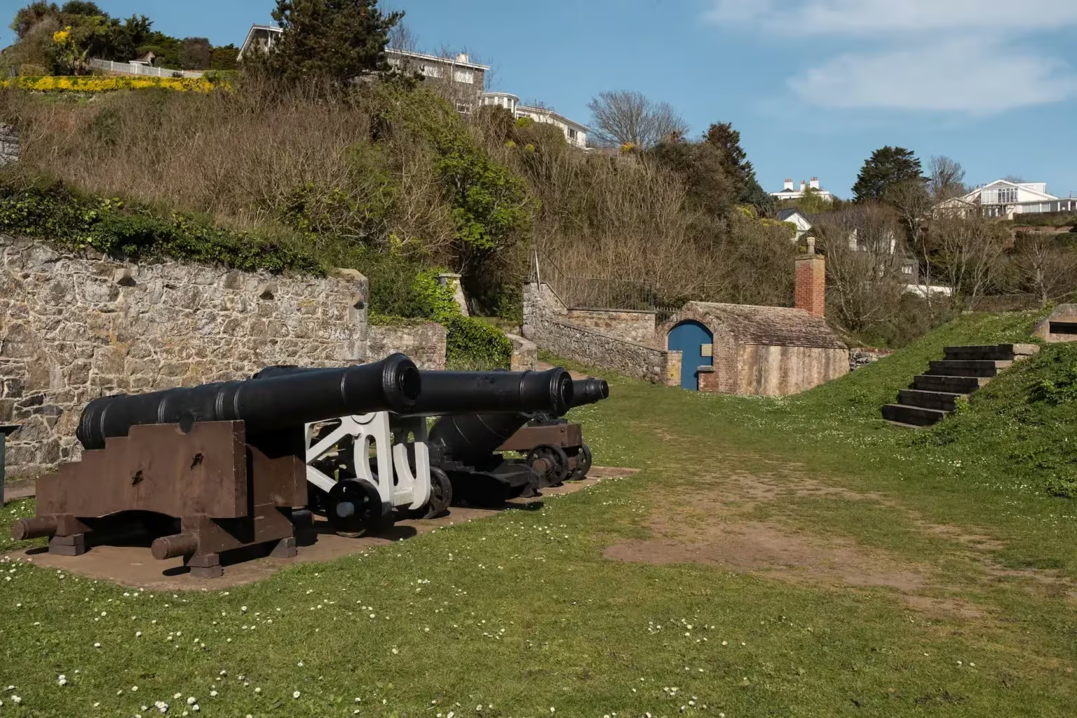
Clarence Battery
Bugs and Beasties
Short grass (Clarence Battery)
Look here for
- Grasshoppers, ants, and beetles — get down low in the grass to look for these. Stay still and quiet for a few moments; as your eyes adjust, you'll start to see more.
- Butterflies and bees — any flying insects are very affected by wind and weather. Look for them by the flowers in the grass.
- Small spiders — look for their webs in sheltered spots, sometimes even between blades of grass.
- Hoverflies and ladybirds — rarely seen, but worth keeping an eye out for.
A smartphone can be very useful for identifying insects and taking photos. We suggest ObsIdentify.
Be gentle — handle insects carefully to avoid damage and return them to where you found them.
History of La Vallette
Fort George
Castle Cornet was for centuries the seat of the Governor and the English garrison of regular soldiers. Their numbers were added to by the Guernsey militia — since at least 1300, in which all able-bodied men were required to serve.
During much of the 18th century, Britain and France were at war. With the British navy being overstretched due to the American conflicts in 1778, the Channel Islands were vulnerable, and coastal defences were strengthened, both by the construction of towers around the coast. Construction was started at Fort George to house the larger garrison that was required. Work started in 1780, and the date of completion was set as 1812, although further construction occurred after that time.
The explanatory boards in this location give further information about the history of the area.
The fort saw military action during its construction in March 1783. This was caused by a mutiny of the 104th Regiment who were inside the fort. This mutiny was crushed by the Lieutenant Governor, Paulus Irving, leading the 18th Regiment and the island's militia.
Literary Route
L'Archipel de la Manche
Victor Hugo describes Guernsey:
Granite in the south, sand in the north; steep slopes on the one hand, sand dunes on the other. …
A green carpet puckered in folds and fringed by the foaming ocean; low lying gun emplacements along the coastline; fortified towers at intervals. …
Everywhere, cyclopean walls; those in the old harbour are now sadly destroyed, but they used to be magnificent with their huge, unevenly shaped stones, their mighty bollards and their heavy chains.
Plant Spotter
Clarence Battery
At first glance all you see here is grass. But look again! This area is home to a range of interesting plants that you may be able to spot. Plants here do vary throughout the year.
This is a "species rich" grassy area. Maintenance approaches such as leaving strips unmown and avoidance of use of pesticides and fertilisers has led to an increase in how this area can support local plants and wildlife.
Look for
- Wild garlic
- Lesser celandine
- Red campion
- White clover
- Common daisy
- Dandelion
Walking for Health
Stretch
After all those steps, now is a good time to find a space to stretch out. Find a place with a lovely view and make the most of being out in the open air.
Some quick stretching exercises are ideal to loosen up with — but listen to your body, do what you feel comfortable with, and focus in on areas that need more time. There are many stretching routines available — find one that suits your needs.
Rocks and Geology
Congratulations, you have climbed the escarpment formed between the Gneiss to the south and Granite to the North. This steep slope goes westwards all the way to Perelle in St Saviours.
How high above sea level are you? Have a guess. Clue -it is almost the length of a swimming pool (answer – 24 meters)
The building materials in use here include stone, brick and concrete. Have a look around the Clarence Battery and see if you can spot the different materials used here. Think about why different materials have been used for different sorts of construction.
Try using your phone to identify the rocks, e.g. with Google lens. Explore the rocks for textures, look for veins and admire colours.
Stand on the concrete platform or on the raised table area.
The islands in front of you are Herm, Jethou, Crevichon, Fauconniere, Sark and L’Etac. You can also see Brehon Tower. Use a map to help you identify the islands. (link to google maps?)
Do you think you could ever have walked between the islands? (answer- No)
When were the Channel Islands connected to mainland France? (answer- very approximately Jersey 7000-8000 years before present, and Guernsey 11,000 years before present)
11,000 years ago, sea levels were much lower, and the islands were part of a land mass that extended into what is now northern France. Even today, geographically and ecologically, Guernsey is more closely related to Normandy than to the UK.